| < Previous page | Next page > |
Export Menu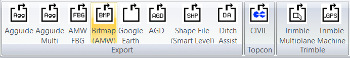
Click on the appropriate export option to create an export file.
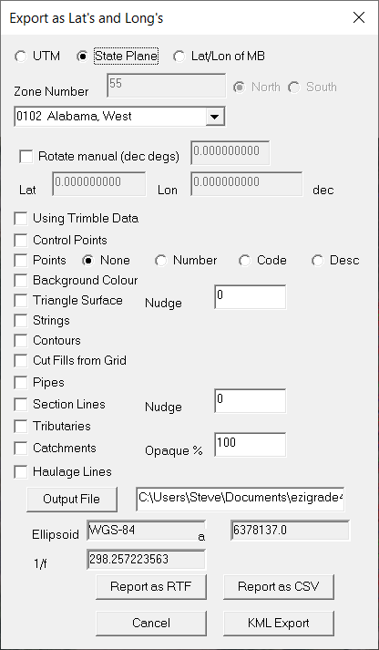
Export -> DXF/DWG
This creates a dxf/dwg of the planview. We display the following dialog.
First Browse to the directory you want the export in. Type in an export name. If you have a dwg extension we get a dwg file or enter dxf to get a dxf. If you highlight the appropriate entity for example "Control Points". On the right you get additional parameters that you can set. Left click the entity type on the left to include these entities. Hot "OK" to create the file or "Cancel" to escape and do nothing.
Export -> Agguide:
This creates a file for Precision Technolgy LevelGuide/Agguide system. We have the following dialog:
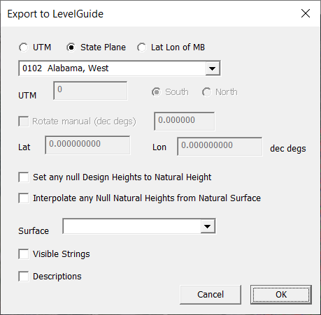
Make sure you have the correct coordinate system set. LevelGuide needs georeferenced data to operate. Normally I would suggest checking both "Set any null Design Heights to Natural Height" and "Interpolate any Null Natural Heights from Natural Surface"
It works on a surface and you would normally pick a design surface in the Surface combo box. Your choice whether you wish to include strings and/or Descriptions.
Export -> Google Earth:
Export your design to google earth. Always good for a check that coordinates are correct.
Make sure your coordinate system is set. Do it once from the File -> Geoid menu item. Select what you wish to export.
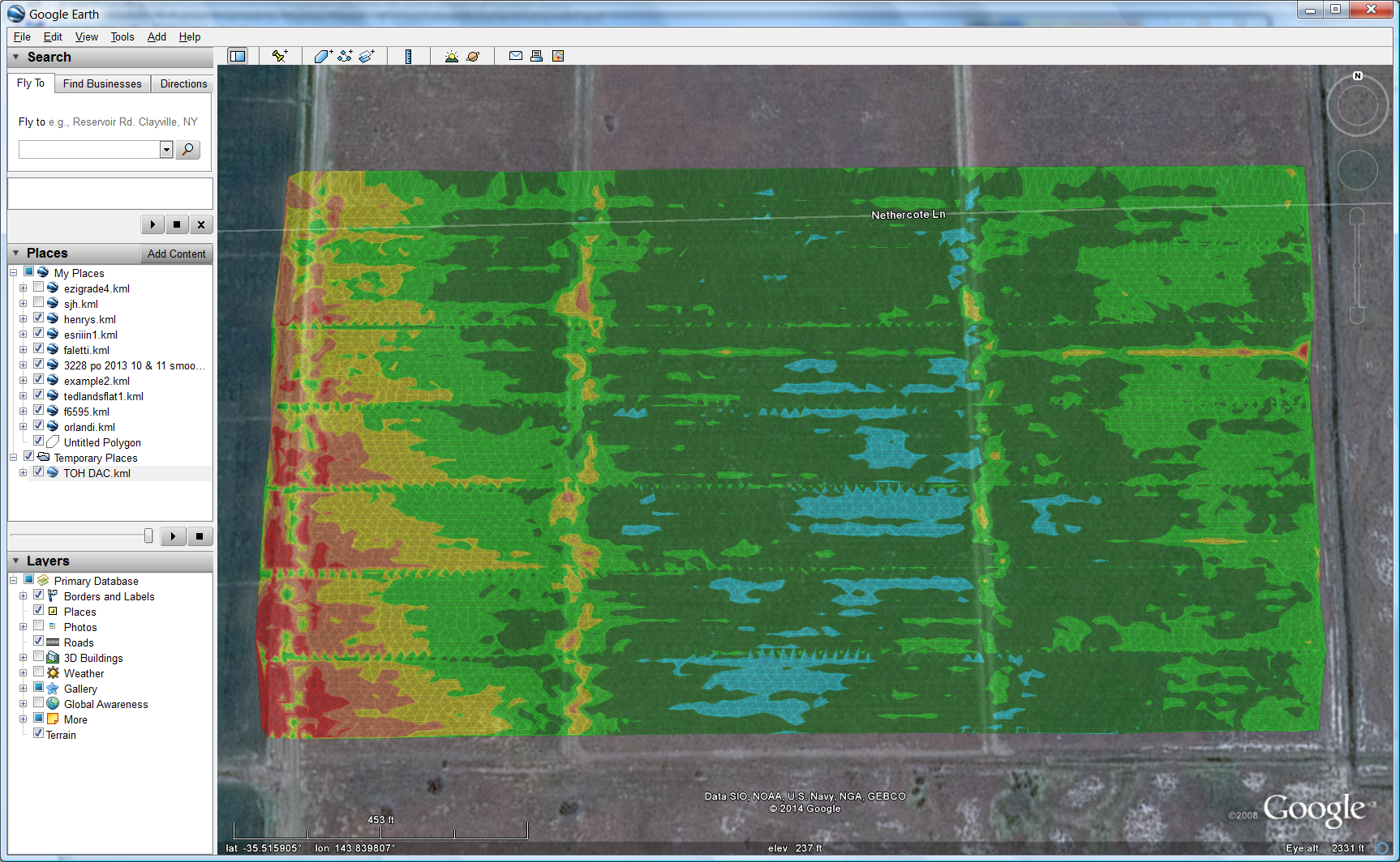
Seen below is a sample design showing cut and fills overlayed upon Google Earth.
 Export -> Ditch Assist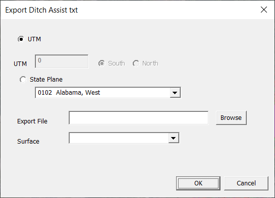
For filename use a .txt extension and select a design surface.
Topcon
This is an export for Topcon Civil jobs. The routine automatically creates all the appropriate files such as PT3, TN3, LN3 files etc for the job. These can be enacted directly on your Topcon machine. Alternatively you export a LandXML and import this via Topcon Office-3D.
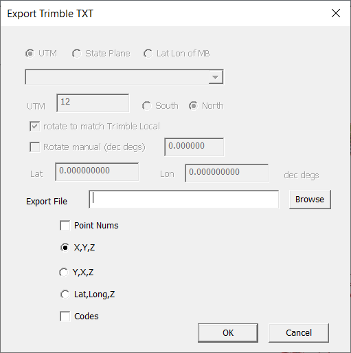
TrimbleExport -> Trimble TXT
Dialog is shown below. Select the CSV file that you require.
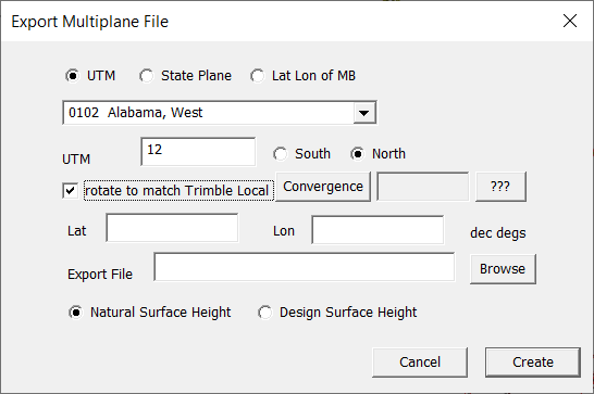
 Export -> Multiplane
This creates the multiplane type file. Handy for giving a survey to someone that still runs MultiPlane software.
 Export -> Trimble Machine (gps) file
This creates a file compatible with a Trimble FMX / TMX or later Trimble controllers. Click on this link for more. Export Trimble Machine:
Trimble CivilExport -> Trimble Cal file
This creates a calibration file for Trimble Civil hardware. You can also include contol points in here if they have know lats/longs. Set relevant points in Ezigrade. However you don't need to do this if you specify either UTM or State Plane coordinate systems. Set this in File -> Geoid.
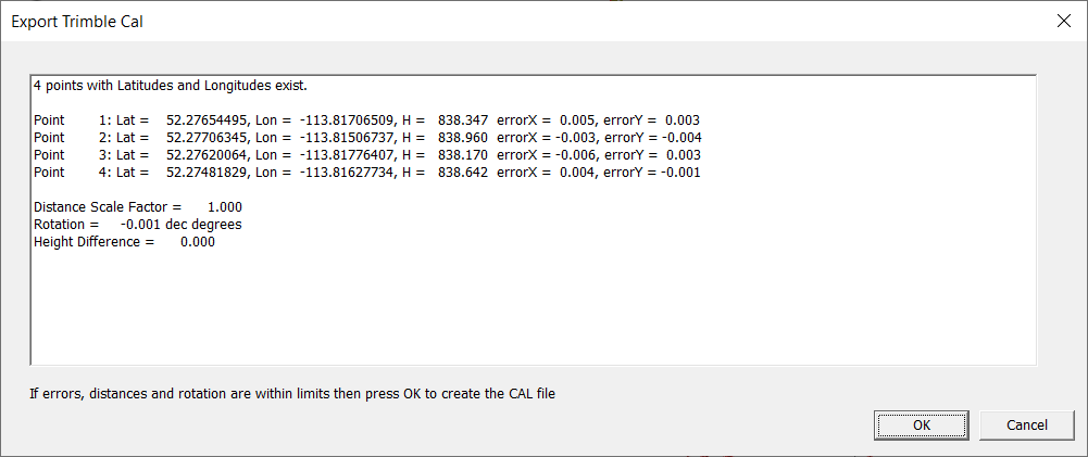
Click OK and enter in a file name when asked.
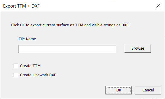
Export -> TTM+DXF
Normally you would create a TTM file and a DXF together, hence the single dialog. Only tick which files you need to create. At present make sure you are displaying the triangle file you wish to export. We will add in functionality shortly to allow you to select the surface.
We intend to create a SVD / SVL export function in the near future.
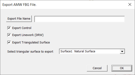
AMW Geologic files
The FBG option now includes the linework option so just use this.
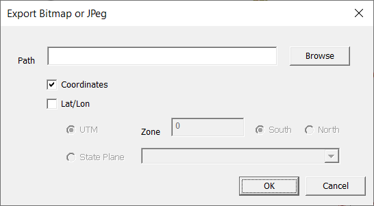
You can also display a background bitmap. Make sure your current view displays what you want in the bitmap
 |